NC Winter Weather Climatology
(1895-2023)
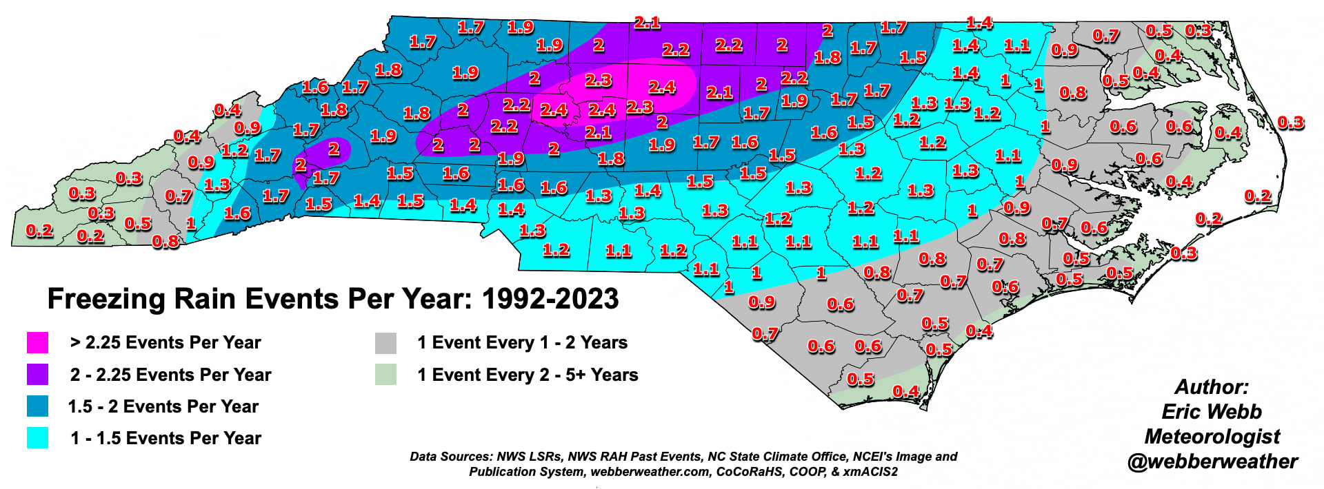
Average Number of Freezing Rain Events Per Year (1992-2023)
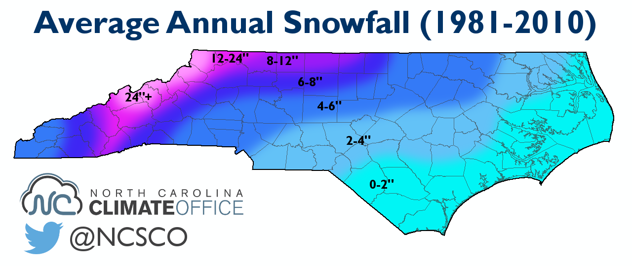
1981-2010 NC Snowfall Climatology (via NC State Climate Office)
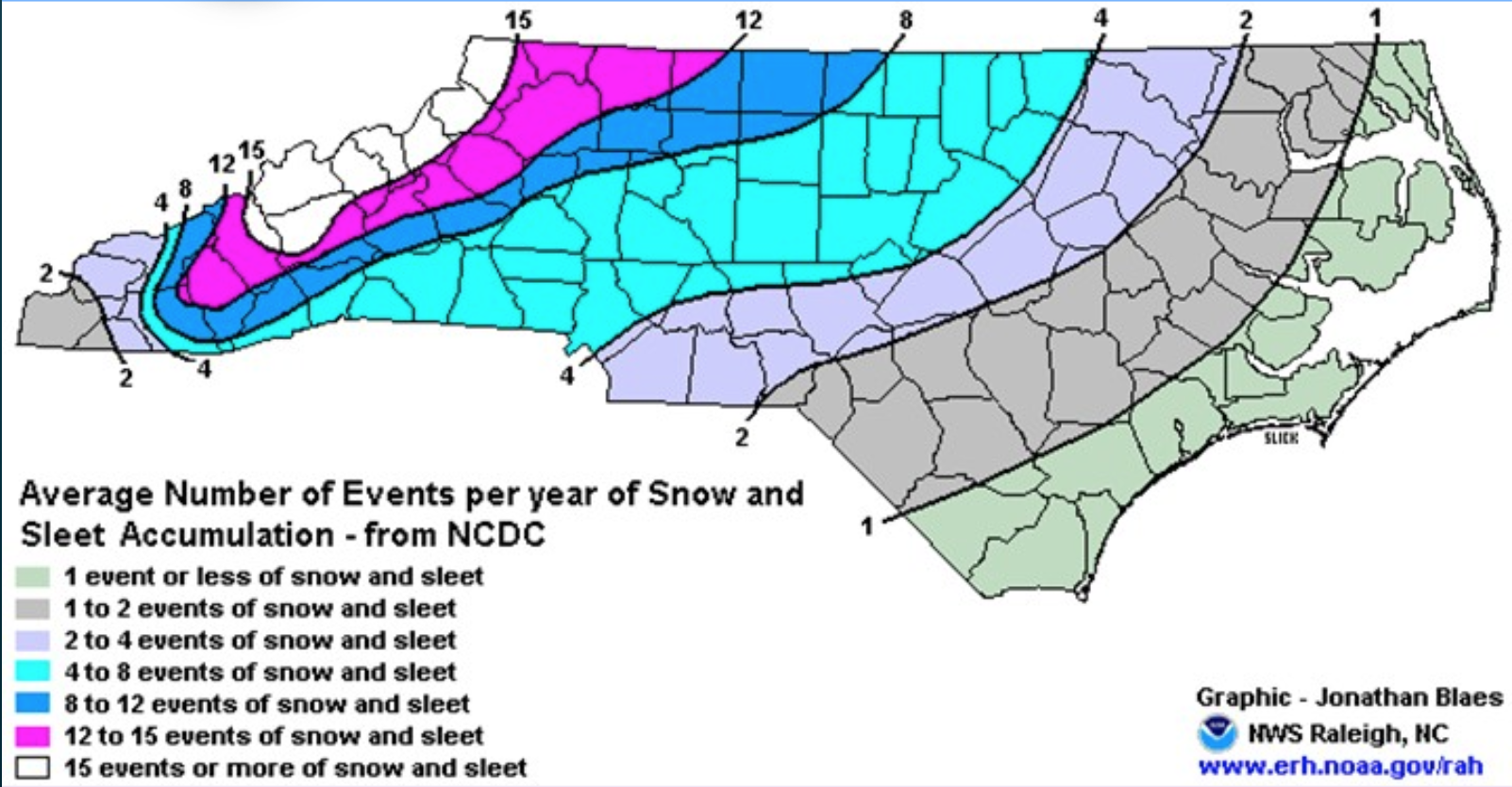
Average Number of Events per year of Snow & Sleet Accumulation (via Jonathon Blaes NWS RAH)
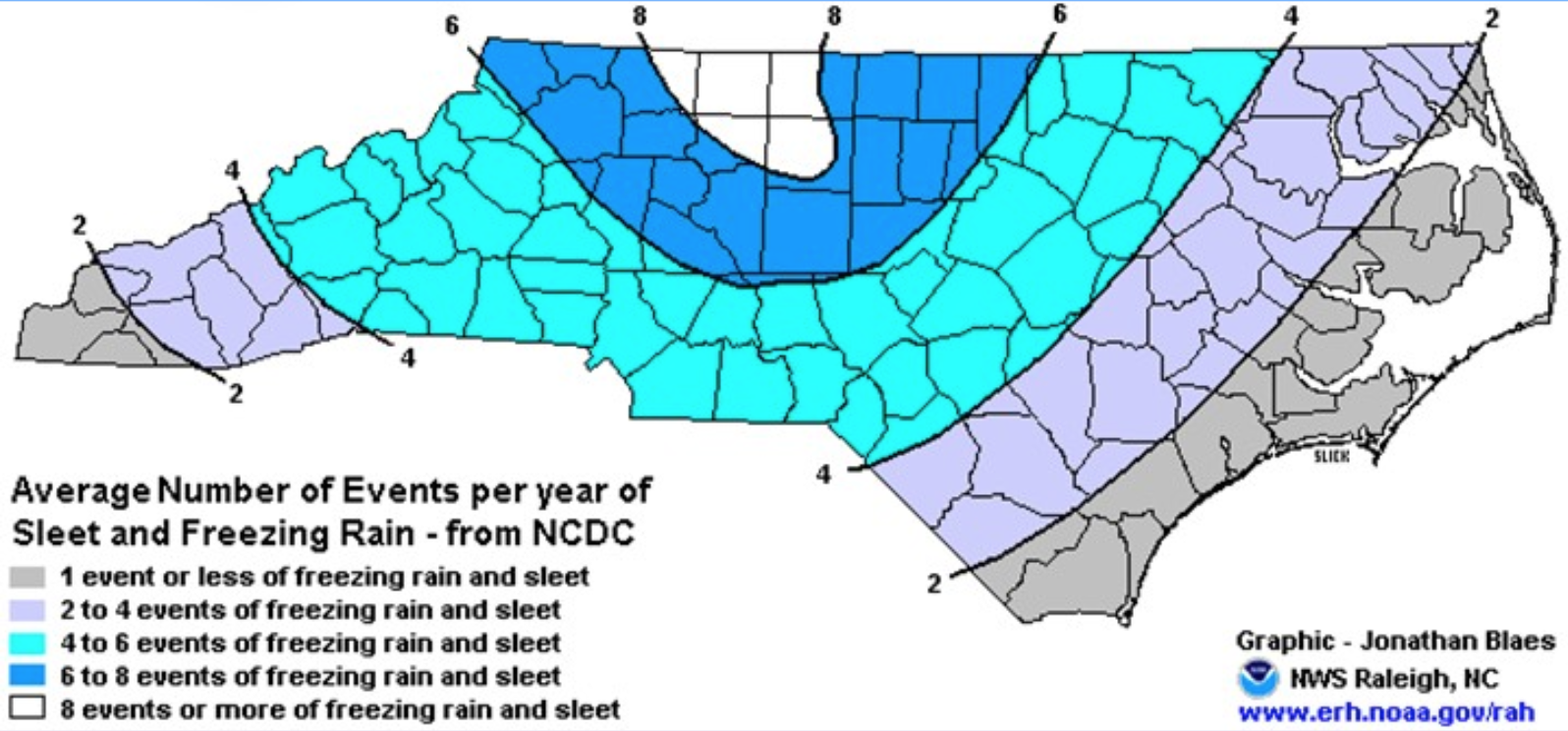
Average Number of Events Per year of Sleet and Freezing Rain (via Jonathon Blaes NWS RAH)
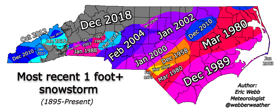
Most Recent 12"+ Snowstorm (1895-2021)
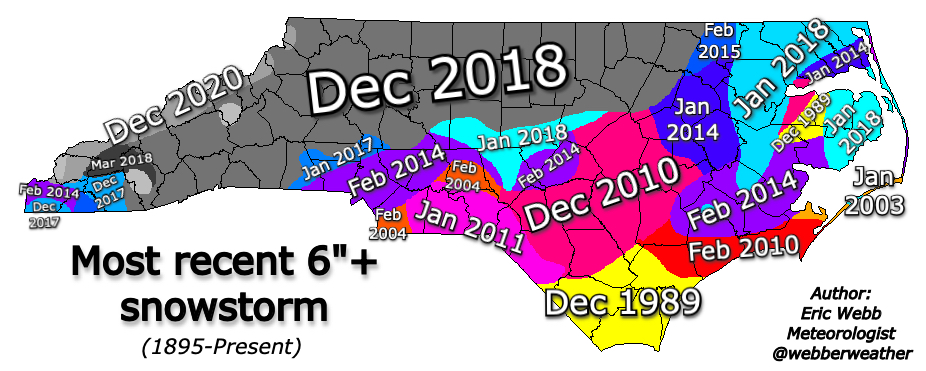
Most Recent 6"+ Snowstorm (1895-2021)
1981-2010 NC Snowfall Climatology (via NC State Climate Office)
Average Number of Events per year of Snow & Sleet Accumulation (via Jonathon Blaes NWS RAH)
Average Number of Events Per year of Sleet and Freezing Rain (via Jonathon Blaes NWS RAH)
Most Recent 12"+ Snowstorm (1895-2021)
Most Recent 6"+ Snowstorm (1895-2021)
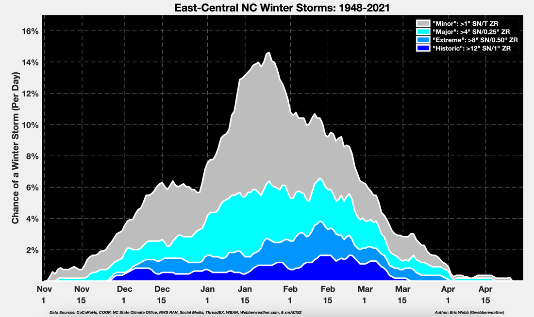
East-central North Carolina Winter Storm Daily Climatological Probability (Jan 1948-Apr 2021) (smoothed w/ a 15-day running mean). Snow events are defined when at least one observation in non-mountain NCEI climate division areas produces: "Minor" (light gray) at least 1" of snow or Trace of glaze, "Major" (light blue) > 4" of snow or at least 0.25" of glaze, "Extreme" (medium blue) > 8" of snow or at least 0.50" of glaze, "Historic" (deep blue), > 12" of snow or at least 1" of glaze.
**Notice the climatological peak of more intense winter storms is later in the winter season than "minor" events**
**Notice the climatological peak of more intense winter storms is later in the winter season than "minor" events**
Snowfall Accumulation Decadal Mean Maps
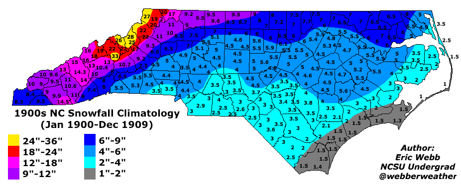
1900s Statewide Snowfall Mean
1910s Statewide Snowfall Mean
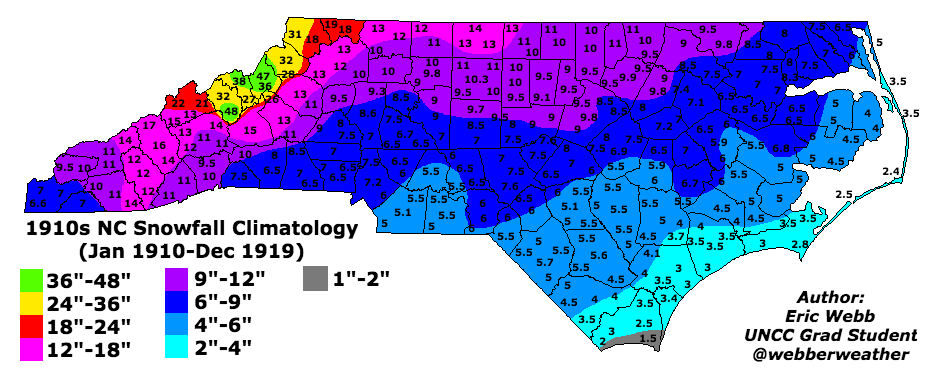
1920s Statewide Snowfall Mean
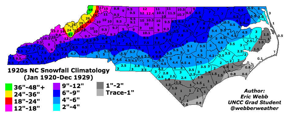
1930s Statewide Snowfall Mean
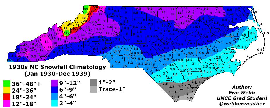
1940s Statewide Snowfall Mean
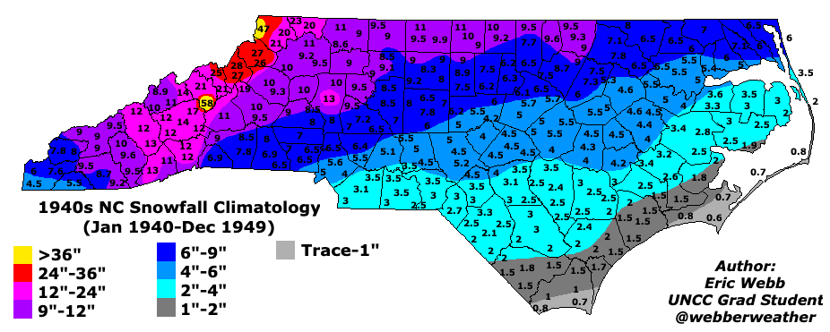
Winter Storm Composites
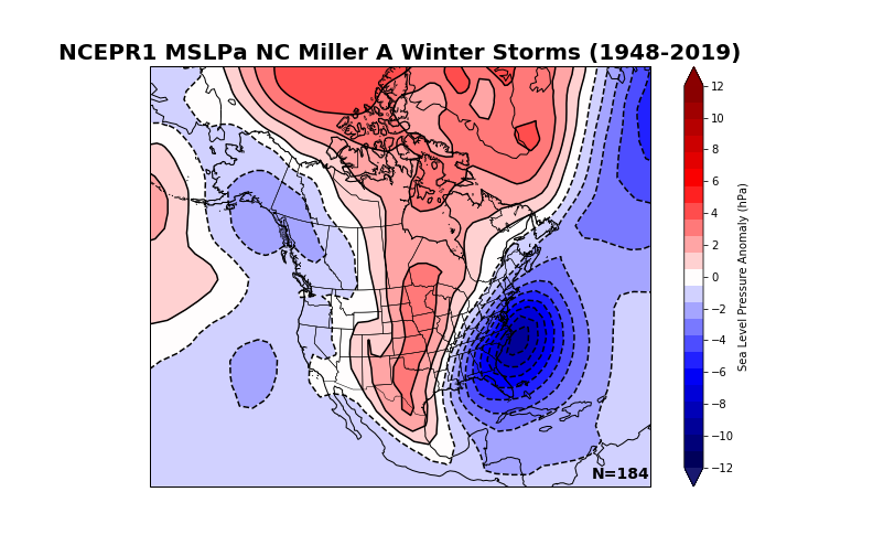
"Miller A"/coastal cyclones mean daily NCEP-R1 Sea Level Pressure (SLP) anomaly (1948-2019)
"Miller A"/coastal cyclones mean daily NCEP-R1 500mb anomaly (1948-2019)

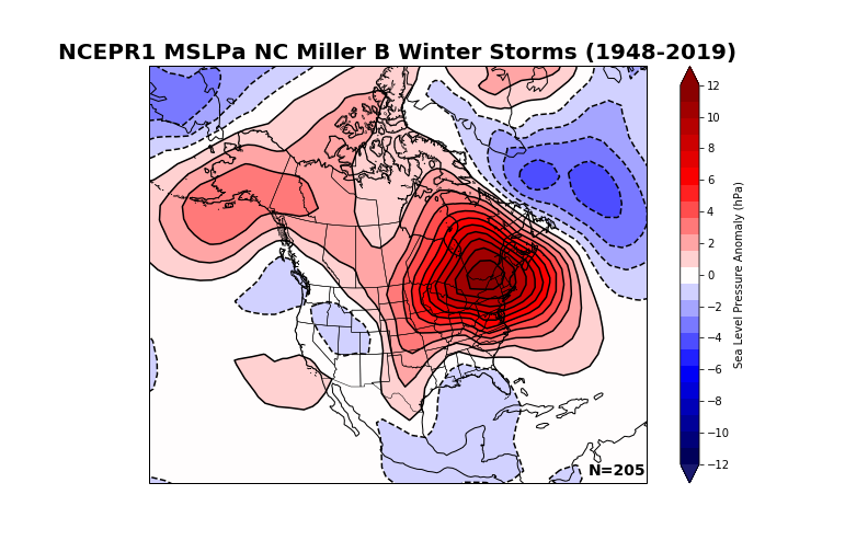
"Miller B"/Cold Air Damming (CAD) events mean daily NCEP-R1 Sea Level Pressure (SLP) anomaly (1948-2019)
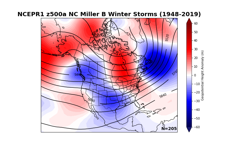
"Miller B"/Cold Air Damming (CAD) events mean daily NCEP-R1 500mb anomaly (1948-2019)
Products Coming Soon
Statewide Seasonal Snowfall Mean (1895-2021)
Monthly NC Winter Storm Climatology (1895-2021)
Average Number of Events per year of Snow & Sleet Accumulation (1895-2021)
Statewide Snowfall Accumulation Mean Maps Per Decade (1950s - 2010s)
Single-Storm Snowfall Statewide Probabilities of a Trace, 1", 2", 4", 6", etc. (1895-2021)
Statewide Relative Probabilities of Greater Single-storm Snow and Sleet Accumulation vs location "x" (1895-2021)
Long-term Statewide Seasonal Snowfall Trend (1895-2021)
Average Statewide Snowfall according to Teleconnection Phase (ENSO, AO, NAO, PNA, EPO, WPO, etc.) (1895-2021)
Winter Storm Composites with ERA-5 & NOAA 20CRv3